⚡ Convective Thermodynamics Treatise
An in-depth thermodynamic and fluid-dynamical analysis of deep moist atmospheric convection. We dissect Convective Available Potential Energy (CAPE), Convective Inhibition (CIN), the Level of Free Convection (LFC), turbulent entrainment rates, and the lifecycle of supercell cumulonimbus systems.
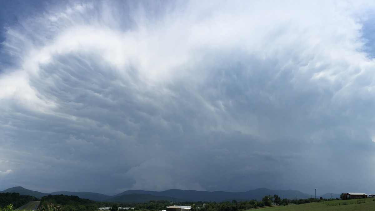
Among all atmospheric phenomena, the cumulonimbus cloud stands as the undisputed titan of tropospheric energy dissipation. A mature cumulonimbus storm is a thermodynamic heat engine of colossal proportions, capable of processing millions of tons of water vapor and releasing thermal energy equivalent to multiple thermonuclear detonations within a span of several hours. Spanning the entire vertical breadth of the troposphere—often from a planetary boundary layer base below 1,000 meters to an overshooting anvil top breaching 18 to 20 kilometers into the lower stratosphere—the cumulonimbus is the physical conduit through which Earth redistributes excess solar thermal energy from the equatorial surface into the upper atmosphere and towards the poles.
The genesis, maturation, and ultimate decay of a cumulonimbus cloud are dictated by the laws of classical thermodynamics and moist turbulent fluid dynamics. For deep convection to initiate, the atmospheric column must simultaneously fulfill three non-negotiable thermodynamic prerequisites: an abundant supply of low-level atmospheric moisture, an unstable environmental thermal lapse rate that allows rising parcels to maintain positive thermal buoyancy, and a dynamic lifting mechanism capable of forcing surface air parcels to their Level of Free Convection (LFC).
1. Thermodynamic Sounding Analysis: LCL, LFC, EL, and Buoyancy Integrals
To quantify the convective potential of an atmospheric column, operational meteorologists rely on thermodynamic soundings obtained via radiosondes, plotted on Skew-T Log-P thermodynamic diagrams. Tracking a hypothetical test parcel of warm, moist surface air as it ascends reveals the critical thermodynamic reference levels that determine convective initiation:
| Thermodynamic Parameter | Full Scientific Name | Physical Definition | Mathematical / Thermodynamic Expression | Operational Significance |
|---|---|---|---|---|
| LCL | Lifting Condensation Level | Pressure altitude where an ascending dry parcel cools to its dewpoint | T_dew = T_parcel (RH = 100%) via dry adiabatic ascent | Demarcates the precise flat visual base of convective cumulus clouds |
| LFC | Level of Free Convection | Altitude where parcel temperature first exceeds ambient environmental temperature | T_parcel(z) > T_env(z) across moist adiabat | Point where parcel achieves spontaneous positive buoyancy and accelerates upward |
| EL | Equilibrium Level (Limit of Convection) | High-altitude level where parcel cools back to match ambient temperature | T_parcel(z) = T_env(z) at top of CAPE integral | Establishes the horizontal spreading height of the cirrus anvil cloud |
| CAPE | Convective Available Potential Energy | Total positive buoyant energy integrated from LFC to EL | Integral from LFC to EL of g * [(theta_v_p – theta_v_e) / theta_v_e] dz | Predicts theoretical maximum vertical updraft speed: W_max = sqrt(2 * CAPE) |
| CIN | Convective Inhibition | Negative buoyant work required to lift parcel from surface to LFC | Integral from Surface to LFC of -g * [(theta_v_p – theta_v_e) / theta_v_e] dz | Atmospheric ‘cap’ or lid that prevents premature convective overturning |
2. The Buoyancy Equation and Theoretical Updraft Velocity
The vertical motion of an ascending parcel inside a convective cloud is driven by the vertical momentum equation, where net vertical acceleration dw / dt is governed by the buoyancy force per unit mass B, modified by water loading and non-hydrostatic vertical perturbation pressure gradients. In its fundamental form, buoyant acceleration is expressed as:
B = g * [ (T_v_parcel – T_v_env) / T_v_env ] – g * q_l
where g is gravitational acceleration (9.81 m/s²), T_v_parcel and T_v_env are the virtual temperatures of the parcel and environment respectively (incorporating the density-reducing effect of water vapor), and q_l represents the hydrometeor mass loading (the downward drag exerted by suspended liquid water and ice hydrometeors). Integrating this positive buoyancy force from the LFC to the EL yields the Convective Available Potential Energy (CAPE), expressed in Joules per kilogram (J/kg):
CAPE = Integral_{z_LFC}^{z_EL} B dz
Under idealized parcel theory—assuming zero friction, no entrainment, and no hydrometeor water drag—all potential energy converts directly into kinetic energy. The theoretical maximum vertical updraft velocity W_max achieved at the Equilibrium Level is given by the classic relation:
W_max = sqrt( 2 * CAPE )
In extreme severe convective environments across the central United States or the Bengal basin, CAPE values can surpass 4,000 to 5,000 J/kg, yielding theoretical updraft speeds exceeding 90 to 100 meters per second (over 320 to 360 km/h). In reality, however, observed updraft velocities in mature cumulonimbus storms rarely exceed 50% to 60% of this theoretical maximum, peaking between 40 and 65 m/s. This significant deceleration is caused by two powerful physical damping mechanisms: downward hydrometeor mass loading and turbulent lateral entrainment.
3. Turbulent Entrainment and Dilution of the Convective Core
In idealized parcel theory, the rising air parcel is assumed to remain completely isolated from its surrounding environment as it ascends. In real atmospheric fluids, however, an ascending convective updraft is a highly turbulent thermal plume that violently interacts with the surrounding environmental air. This process of incorporating ambient environmental air into the convective updraft is termed entrainment.
Entrainment operates via two primary fluid mechanisms: turbulent shear mixing along the outer perimeter of the updraft conduit, and large-scale dynamic drawing of air driven by internal pressure perturbations. Because environmental air in the mid-troposphere (typically between 700 hPa and 500 hPa) is vastly drier and cooler than the warm, saturated updraft core, entrained air exerts a devastating thermodynamic double-blow upon the storm:
- Thermal Dilution: Mixing colder environmental air directly reduces the parcel’s thermal advantage, depressing its virtual temperature and directly slashing buoyant acceleration B.
- Evaporative Cooling: Unsaturnated environmental air forces cloud droplets to evaporate rapidly to restore chemical equilibrium. Because evaporation absorbs massive quantities of latent heat of vaporization from the air parcel, temperatures plunge drastically, transforming positive buoyancy into negative buoyancy.
The fractional rate of entrainment mu scales inversely with the updraft radius (mu ~ 0.2 / R). Consequently, narrow convective updrafts (radii < 500 meters) suffer catastrophic entrainment dilution, causing their buoyant energy to erode and collapsing their vertical ascent before ever reaching the upper troposphere. Conversely, wide convective updrafts (radii > 2 to 5 kilometers), such as those found in organized supercell thunderstorms, possess high area-to-perimeter ratios. Their central cores remain shielded from turbulent lateral entrainment, allowing undiluted parcel ascent that realizes near-theoretical updraft velocities and penetrates vigorously into the lower stratosphere.
🌪️ Overshooting Tops and Tropopause Penetration
When an extreme updraft reaches the Equilibrium Level (EL), its vertical velocity is so immense that inertia drives the cloud column thousands of meters past its neutral buoyancy level into the stable stratosphere, creating an ‘overshooting top’. This visible dome indicates an exceptionally violent updraft capable of generating giant hail and intense tornadoes.
4. Convective Anatomy: Glaciation, Anvil Spreading, and Downdraft Dynamics
As the cumulonimbus updraft breaches the -10 degrees Celsius level, supercooled water droplets begin interacting with ice-nucleating particles. When the updraft reaches -38 degrees Celsius, homogeneous freezing occurs spontaneously: every remaining liquid droplet instantly crystallizes into solid ice. This phase transition liberates the latent heat of fusion (approximately 3.34 x 10^5 J/kg), providing a second thermal boost—known as the ‘glaciation surge’—that accelerates the updraft through the upper troposphere.
Upon striking the strong thermal inversion of the tropopause, the vertical ascent is abruptly arrested. Unable to penetrate further into the highly stable stratosphere, the massive volume of ascending air is forced to diverge horizontally in all directions, forming the characteristic anvil cloud (incus). Strong upper-level winds sheer the anvil downwind for hundreds of kilometers, creating an expansive shield of fibrous cirrus and cirrostratus.
Simultaneously, the immense mass of suspended rain and hail accumulated in the upper levels cannot be supported indefinitely by the updraft. As hydrometeors fall, they drag ambient air downward via frictional momentum transfer. As this precipitation plunges into dry air beneath the cloud base, rapid evaporation of rain and sublimation of hail chills the air column, creating dense, negatively buoyant downdrafts. Upon striking the planetary surface, this downdraft spreads out laterally as a powerful gust front (outflow boundary), often spawning severe downbursts and providing the mechanical lifting trigger needed to initiate secondary thunderstorm cells along its leading edge.
5. Vertical Wind Shear and Hodographs: Organization into Supercell Systems
While thermodynamic instability (CAPE) governs the potential updraft velocity, the ultimate organizational structure and longevity of a cumulonimbus cloud are dictated by deep-layer vertical wind shear—the change in horizontal wind velocity and direction with altitude. In an environment devoid of vertical wind shear, a convective updraft ascends vertically. As hydrometeors form and accumulate overhead, they inevitably fall back directly through the updraft core. The resulting precipitation drag and evaporative downdraft choke the upward supply of warm, moist air, extinguishing the single-cell thunderstorm within 30 to 50 minutes.
Conversely, when strong vertical wind shear exists in the 0–6 kilometer layer (exceeding 20 meters per second or approximately 40 knots), the spatial dynamics are transformed fundamentally:
- Updraft Tilting: Moderate to strong unidirectional shear tilts the convective column downshear, causing precipitation to fall adjacent to the updraft rather than directly through it. This spatial decoupling prevents downdrafts from suffocating the convective core, allowing the system to regenerate continuously as a long-lived multicell cluster or squall line.
- Vorticity Ingestion and Tilting: In directional shear environments—where low-level winds veer clockwise with height (e.g., southeasterly at the surface, southwesterly at 850 hPa, and westerly at 500 hPa)—the environmental shear vector possesses abundant horizontal vorticity. When the convective updraft interacts with this horizontal vortex line, it tilts the horizontal rotation into the vertical, imparting mid-level cyclonic rotation to the updraft.
- Supercell Genesis and Mesocyclone Dynamics: A cumulonimbus characterized by a persistent, rotating updraft is designated a supercell. The rotating updraft—termed a mesocyclone—develops a deep dynamic vertical perturbation low-pressure core governed by the non-hydrostatic diagnostic pressure equation. This dynamic suction pressure accelerates low-level inflow into the storm independently of thermal buoyancy, insulating the supercell from ordinary entrainment limits and generating the most devastating severe storms, giant hailstones, and violent tornadoes on Earth.
6. Severe Convective Hazards: Microburst Fluid Dynamics and Hailstone Growth
A mature cumulonimbus generates some of the most concentrated severe weather hazards in atmospheric physics. Two primary manifestations of this energy dissipation are severe downdrafts—termed microbursts—and giant hailstone accretion.
Microburst Fluid Dynamics: Pioneered by severe weather researcher Ted Fujita in the late 1970s, a microburst is defined as an intense, localized column of sinking air that produces damaging divergent winds on or near the ground spanning less than 4 kilometers in horizontal diameter, with peak wind speeds capable of exceeding 75 meters per second (over 270 km/h). Microbursts are classified into two thermodynamic categories:
- Wet Microbursts: Occurring in high-CAPE, high-precipitable-water environments (such as the southeastern United States). Heavy precipitation cores descend rapidly, driving downward momentum through hydrometeor mass drag. As unsaturated dry air is entrained into the precipitation core, intense evaporative cooling creates a dense, rapidly sinking cold air bubble that slams into the surface, spreading out as a violent horizontal vortex ring.
- Dry Microbursts: Characteristic of semi-arid continental environments (such as the American High Plains). These develop from high-based cumulonimbus clouds or altocumulus castellanus rooted above a deep, hyper-dry boundary layer featuring an ‘inverted-V’ thermodynamic sounding. Rain falling from the cloud base evaporates completely before reaching the ground (forming virga). The monumental latent heat absorbed by evaporation cools the mid-level air parcel by several degrees Celsius below the ambient environment, converting it into a dense, plunging atmospheric hammer that hits the ground with dry, hurricane-force velocity. Microbursts represent one of the most fatal aviation weather hazards, causing sudden, catastrophic loss of airspeed and lift during aircraft takeoff and landing phases.
Hailstone Accretion Dynamics: Giant hail formation requires a sustained, violent convective updraft capable of suspending dense solid hydrometeors for extended durations. Hail embryos—typically frozen raindrops or graupel particles measuring 1 to 5 millimeters—are swept into the intense updraft core where temperatures range between -10°C and -25°C. In this zone, supercooled liquid water content (SLWC) reaches extreme concentrations. As the embryo ascends, it sweeps out and accretes supercooled droplets that freeze onto its surface. Depending on the updraft velocity and ambient temperature, growth alternates between two microphysical regimes: the dry growth regime (where accreted droplets freeze instantaneously on contact, trapping air bubbles and producing milky, opaque rime ice) and the wet growth regime (where the rate of latent heat liberation exceeds heat conduction away from the hailstone, causing excess liquid water to spread over the surface before slowly freezing, producing crystal-clear glaze ice). This thermodynamic cycling creates the alternating concentric rings characteristic of sliced giant hailstones.